The Pagosa Springs area could see nearly 3 more inches of rain between Friday and Monday, with the bulk of that falling Sunday through Monday.
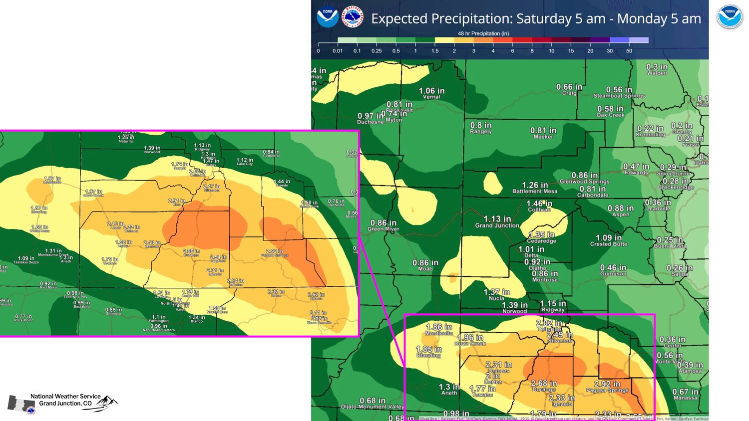
The Pagosa Springs area, according to the National Weather Service (NWS), could see 2.92 inches, with the Pagosa Springs having a 34 percent chance of more than 3 inches.
NWS Meteorologist Erin Walker explained in a briefing Thursday morning that portions of the forecast are are expected to receive 1 to 3 inches, with models favoring the southern zomes for heightened precipitation amounts.
The projected snow level is now expected to be 11,000 feet, which she noted "could be a big game changer."
She noted there is medium confidence in the total available moisture, but still low confidence in the time of arrival of cold and and rain-on-snow potetial, and low confidence on the convective nature (such as heavy rainfall and thunderstorms.
Low confidence: time of arrival of cold air & rain on snow potential Low confidence: convective nature (i.e. heavy rainfall & thunderstorms).
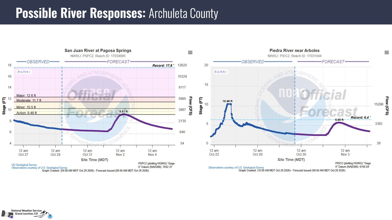
Walker noted river forecasts in the area have increased, with the San Juan River at Pagosa Springs now projected to hit 9.51 feet — in action stage — at about 5 a.m. Monday morning and the Piedra River near Arboles projected to hit 5.69 feet late Monday morning.
Walker expected additional updates to the forecast in the coming days.


 >