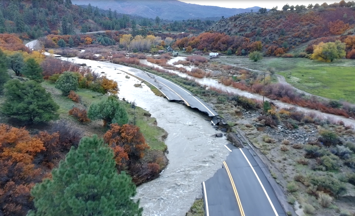
Historic flooding throughout Archuleta County last week caused significant road damage and closures in the region.
Roads in the Town of Pagosa Springs and in Archuleta County were affected, along with damage to Colo. 151 and U.S. 160.
During a community flood meeting held on Tuesday, Oct. 27, County Commissioner Warren Brown indicated that approximately 150 miles of county-jurisdiction roads are currently impassable.
After being shut down on Thursday evening, Oct. 22, Wolf Creek Pass reopened to travel Tuesday afternoon Oct. 27, with single-lane alternating traffic in some stretches.
Town
During the flood, multiple road closures occurred within town limits, including South 6th Street, North 5th Street and Hot Springs Boulevard.
Assistant Public Works Director Brad Lattin explained that South 6th Street and North 5th Street are the only town roads that remain closed as of Wednesday, Oct. 28.
He mentioned that both roads may be closed “for quite some time,” with a major culvert failing near North 5th Street and the river eroding the edge of the roadway along South 6th Street.
Lattin indicated the town is working with Davis Engineering to come up with a repair plan, which might take two to three weeks to develop.
County
According to a map produced by Archuleta County’s GIS department, County Road 500, Trujillo Road, is closed from mile marker 12 to mile marker 19. The map also shows that Alpine Drive in the San Juan River Village is closed, along with other subdivision roads.
Other closures are shown on county roads 326, 339, 391 and on North Pagosa Boulevard, where a portion of the roadway was washed out.
Colorado Department of Transportation
According to an Oct. 28 press release from the Colorado Department of Transportation (CDOT), Wolf Creek Pass has reopened, “but sustained serious damage including a failed culvert, a damaged retaining wall and roadway undercut by the Rio Grande. West of Pagosa Springs, one-way alternating traffic is in place. ”
It also notes that Colo. 151 “was washed out in two locations near mile points 27 and 30. CDOT is planning a temporary access road for residents and emergency responders, followed by permanent reconstruction.”
According to the map produced by the county, Colo. 151 is closed from mile marker 33 to mile marker 23.
The press release also explains that CDOT is requesting federal emergency relief funds “to repair significant flood damage to highways across Southwest Colorado as part of the Federal Highway Administration’s Emergency Relief program.”
It states, “The request estimates $65 million in damage to federal-aid roadways and asks the Federal Highway Administration to release $6.5 million, or 10% of the total, through its quick release process so work can start immediately. In addition, the Transportation Commission has already approved $5 million in emergency funds to assist with immediate work as well.”
clayton@pagosasun.com


 >