Update, 12:40 p.m., Aug. 5:
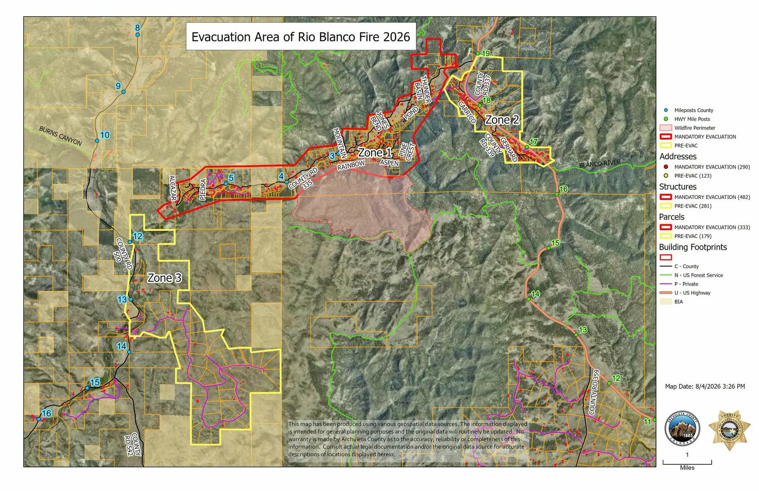
The Archuleta County Sheriff's Office, in coordination with the Rio Blanco Fire Incident Management Team and Archuleta County Emergency Management, has officially lifted the level 1 pre-evacuation order for Zone 3 (including county roads 337, 339 and the Pinon Hills subdivision, including residences from mile marker 12.8 along County Road 500), effective immediately.
Firefighters have made notable progress on containment and perimeter lines, significantly reducing the immediate threat to homes and structures in the Zone 3 area.
The mandatory evacuation orders or remaining pre-evacuation orders for adjacent areas (such as Lower Blanco/County Road 335) remain in effect as firefighting operations continue.
Update, 9:31 a.m., Aug. 5:
Acres: 1,246 | Containment: 12% | Reported: 07/28/26 | Cause: Lightning | Personnel: 401
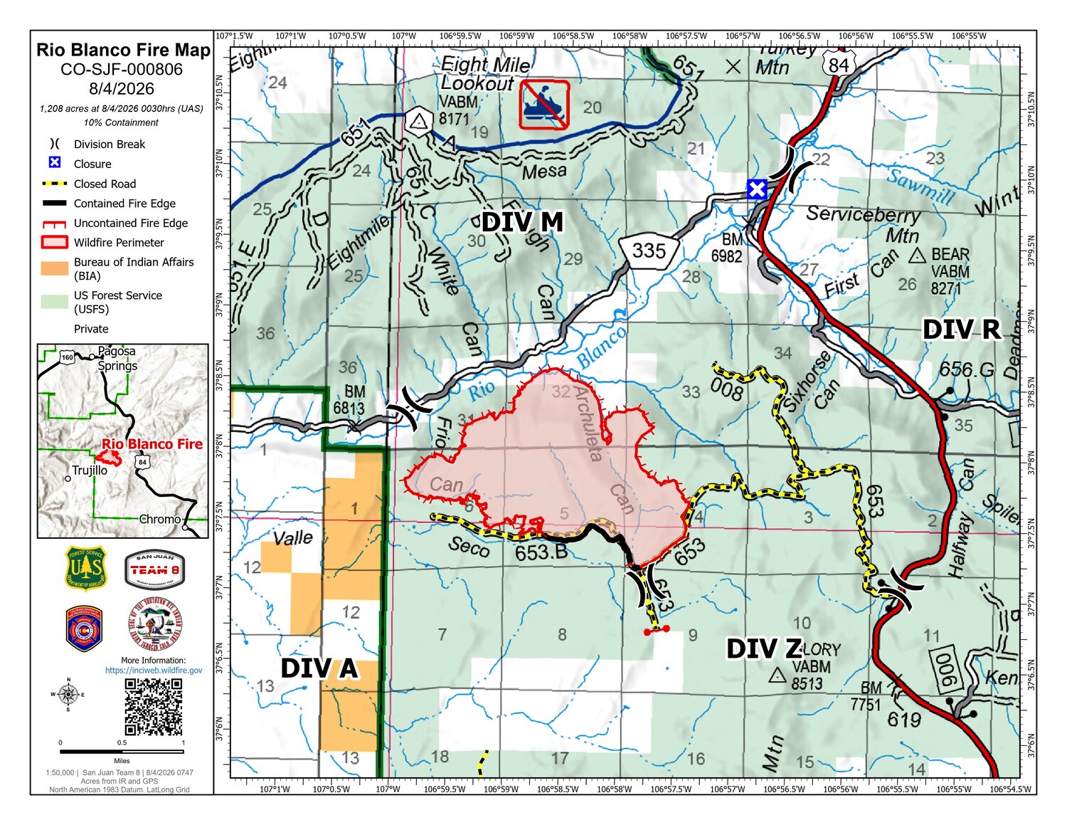
Current situation: Hot and dry weather persisted on Tuesday, causing a significant uptick in fire behavior. Crews worked hard to hold the lines while the fire exhibited intense surface-level activity and frequent group torching. The fire has made its way to the plumbed control lines on Rainbow and Aspen roads and mop up has begun around homes. Containment increased on the southern side of the fire in Divisions A and Z. No structures have been damaged or lost as of the writing of this update and fire managers are feeling optimistic about the progress that is being made.
In the U.S. 84 corridor, structure assessments and protection plans are complete and ready to implement, if necessary. Crews extended a hose lay from the end of the 008 into the Lower Blanco valley along the contingency line that was constructed over the past two days. Along the east and south perimeters, firefighters held the lines, preventing any fire growth in these directions. Frio Canyon presented a challenge yesterday, with the fire aggressively backing almost to the mouth of the canyon. A significant amount of smoke was produced by this heightened activity and both helicopters and air tankers supported firefighters on the ground to keep the fire’s intensity in check.
On the west end of County Road (CR) 335, the homes have been scouted and protection plans developed. Water sources have been established and a cache of structure protection equipment is available if it needs to be deployed. Crews in this area are watching for spot fires thrown out of Frio Canyon into the valley below and will extinguish them. Aircraft were utilized to knock down flare-ups of group torching to limit spotting. A swing shift and a night shift will be assigned to the 335 corridor to keep watch and take action if needed.
Today’s operations: Now that the contingency lines are complete, divisions R and Z will maintain staffing to hold the lines, as ongoing hot and dry weather further cures vegetation, making it more available to burn. In Frio Canyon, firefighters may use firing operations to bring the fire out of the mouth of the canyon, where they can engage it more safely, if weather and fuel conditions allow. Along the south side of CR 335, crews will continue structure protection and mop up efforts throughout the neighborhood.
Closures/evacuations: The
Archuleta County Sheriff’s Office has issued an evacuation order for County Road 335 Lower Blanco, and pre-evacuation orders in place for County Road 337, 339, and Pinion Hills area along County Road 500. Contact the Archuleta County Sheriff’s Office at (970) 508-9928 for more information about evacuations and private land closures. The San Juan National Forest has
multiple road closures in place, including the Valle Seco Road (NFSR 653).
Colorado Parks and Wildlife has temporarily closed boating access at Echo Canyon Reservoir to allow aircraft to safely operate while scooping water to fight the ongoing Rio Blanco Fire.
Weather: Humidity recovery was poor on Tuesday, resulting in the burn period (the time at which fire activity picks up) opening earlier than it had in past days. The fire area experienced near red flag conditions again yesterday with highs in the mid 90s. Wednesday is expected to see a continuation of these conditions. Winds may be slightly lighter than what was seen on Tuesday, averaging 10-15 mph with a few higher gusts.
Update, 8:26 a.m., Aug. 5:
Firefighters continue making steady progress strengthening containment by connecting handline to existing dozer line and previously secured portions of the fire perimeter.
This
video features aerial footage captured yesterday, showing pockets of interior smoke and highlighting the work taking place across the incident.
With coordinated handline construction and planned burnout operations continuing, fire managers anticipate a substantial increase in containment today as crews secure additional sections of the fire's edge.
Update, 8:13 p.m., Aug. 4:
Air operations are a critical component of wildfire suppression, providing rapid, large-scale support to firefighters on the ground. On Sunday and Monday alone, fixed-wing aircraft dropped 16,142 gallons of fire retardant, while helicopters delivered 218,159 gallons of water to support suppression efforts.
Working in close coordination with ground crews, air resources help protect lives, property, critical infrastructure and other values at risk. Air tankers drop fire retardant to slow the fire's spread along its head or active flanks, particularly in areas where firefighters cannot safely engage because of extreme fire behavior. Helicopters equipped with tanks or buckets deliver water to cool hot spots, reduce fire intensity, and support firefighters constructing and holding containment lines. Scooper aircraft and helicopters can also make targeted drops on specific hot spots or threatened structures.
While aerial firefighting is a vital tool, water and retardant drops alone do not extinguish wildfires. Instead, they reduce fire intensity and slow the rate of spread, creating safer conditions for firefighters to move closer to the fire's edge and strengthen containment efforts.
The effectiveness of aerial operations depends on several factors, including weather, fire behavior, terrain, fuel conditions, visibility, aerial supervision capacity, pilot flight-time limitations and overall personnel safety. Strong winds, extreme heat, and rugged terrain can reduce the effectiveness of water and retardant drops, requiring fire managers to continually evaluate when and where aircraft can be used safely and effectively.
Update, 1 p.m., Aug. 4:
Effective immediately, access to the evacuated areas is being suspended. Weather conditions are dictating this closure.
Update, 11 a.m., Aug. 4:
Acres: 1208 | Containment: 10% | Reported: 07/28/26 | Cause: Lightning | Personnel: 374
Community meeting: A community meeting will be held tonight at 6 p.m. at the Archuleta County Extension Office, 344 U.S. 84. Speakers will include the
Archuleta County sheriff and Rio Blanco Fire Incident Management Team members. Following a short presentation, there will be an opportunity to gather around maps with incident and county personnel to ask questions one-on-one. Virtual streaming will be available on Facebook via the San Juan National Forest page. A Facebook account will not be required to view the presentation.
Current situation: Firefighters experienced borderline red flag warning conditions on Monday, with temperatures exceeding 95 degrees on the fireline. In fact, a weather station in the district positioned at 9,300 feet broke temperature records at 87 degrees.
In these conditions, crews completed construction of the contingency line along FR 008, extending a dozer line from the road towards the rim. As the terrain became too steep for heavy equipment, crews transitioned the dozer line into a hand line, tying into the plumbed line around Aspen Road. Structure assessments and protection plans were completed in the U.S. 84 corridor as a backup plan in the event of further fire growth to the east. In Division Z, on the southeast side, the hot, dry weather stoked some unburned islands within the fire perimeter. Firefighters kept single and group tree torching in check near the line with helicopter bucket drops and watched for potential spot fires, but the lines held.
In Frio Canyon, the fireline that crews constructed around Saturday’s slopover held throughout the day on Monday. Resources worked to strengthen that line and keep the fire in its footprint with the help of strategic water drops from air resources. In the Lower Blanco, Sunday evening’s firing operations behaved as intended into the day on Monday. Crews created a linear fire front that backed down the slope with moderate intensity, removing the fuels that could otherwise lead to forceful uphill runs of canopy fire that would threaten the lines and the communities below. Retardant drops were used to reduce fire intensity, as needed. The night shift continued with UAS firing operations Monday night, to bring the fire the rest of the way down to plumbed firelines near Aspen and Rainbow Roads.
Today’s operations: Today, a shift in resources is taking place. The Blue Ridge Hotshots and a 40-person task force are going on days off. To fill in behind them, Upper Colorado River crew, Alpine Hotshots and another 20-person hand crew will be arriving. These new crews will continue coaxing the fire down the slope to prepared and plumbed lines west of Rainbow Road, as well as mopping up the edge where the fire burned to the line near Aspen Road. Crews will extend plumbing up the contingency line today, to further prepare for the possibility of eastward fire growth.
Closures/evacuations: The
Archuleta County Sheriff’s Office has issued an evacuation order for County Road 335 Lower Blanco, and pre-evacuation orders in place for County Road 337, 339, and Pinion Hills area along County Road 500. Contact the Archuleta County Sheriff’s Office at (970) 508-9928 for more information about evacuations and private land closures. The San Juan National Forest has
multiple road closures in place, including the Valle Seco Road (NFSR 653).
Colorado Parks and Wildlife has temporarily closed boating access at Echo Canyon Reservoir to allow aircraft to safely operate while scooping water to fight the ongoing Rio Blanco Fire.
Weather: On Monday, humidity dropped into the lower to mid-teens with west to southwest winds topping out at 12 to 20 mph, with a few higher gusts. High temperatures were in the low to mid 90s. On Tuesday, a continuation of hot and dry conditions is expected, as an upper-level high pressure system remains locked in across the region. Cumulous clouds may develop over higher terrain, but a wetting rain is not expected.
Reminder: If you fly, we can’t. A temporary flight restriction is in place over the fire area. Private aircraft, including drones, are not allowed.
Update, 9:45 p.m., Aug. 3:
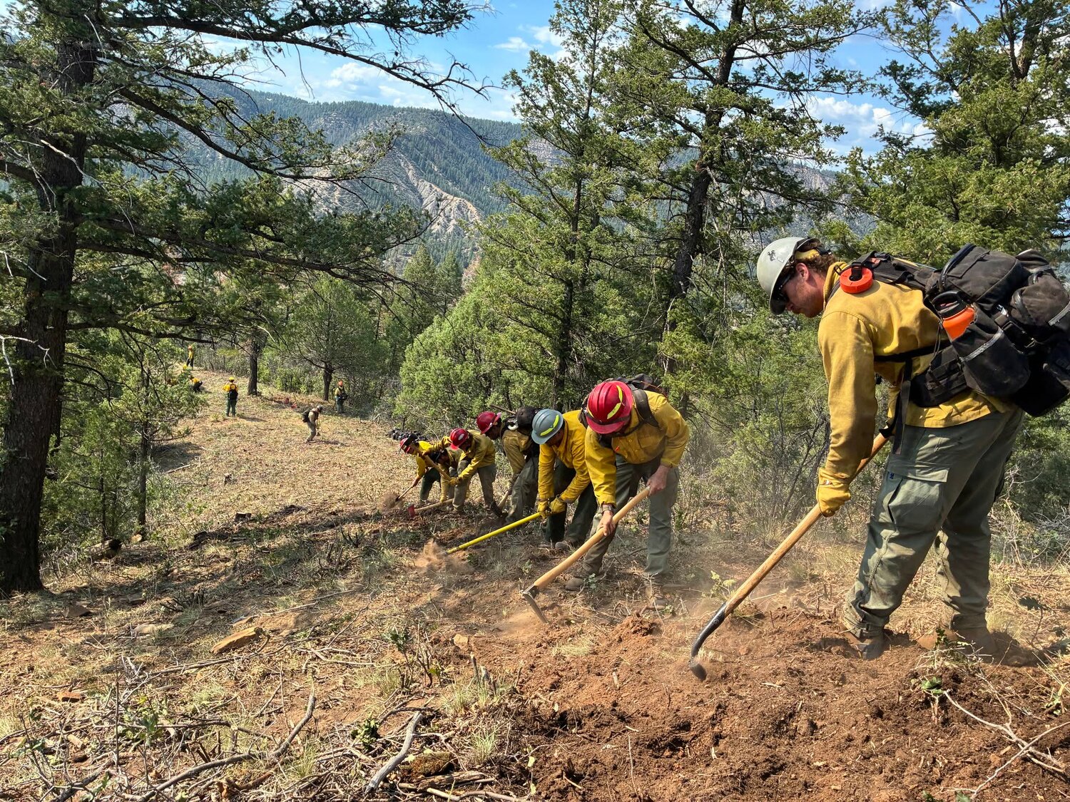
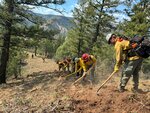
Over the last couple of days, Crew 307 was assigned to Division R, hand cutting a contingency line down a ridge east of Archuleta Canyon. The saw team removed oak brush and trees ahead of "the dig," the women and men who use hand tools to manually dig fireline, cutting through grass and roots down to bare mineral soil. Removing a broad swath of vegetation reduces fire intensity near the hand line so that fire cannot spot across.
Today, this contingency line was completed, tying into a dozer line up high and hand lines in the Lower Blanco, plumbed with hose lays along private property with the objective of creating a continuous boundary that will contain the fire.
Update, 5:31 p.m., Aug. 3:
The firefighters will continue night operations on the Rio Blanco fire this evening, Aug. 3. In response to operations tonight, power to structures along Rainbow Road, Aspen Road, Meadowbrook Place, Maple Glen Place and Pine Crest Drive will be de-energized for a period of time, starting between 7:30 and 8 p.m. this evening.
This will be in coordination with the incident team and La Plata Electric Association (LPEA). Power to these residences will be restored at the earliest and safest opportunity
Thank you as always for your understanding.
Update, 11:09 a.m., Aug. 3:
Acres: 1,114 | Containment: 11% | Reported: 07/28/26 | Cause: Lightning | Personnel: 373
Community meeting: A community meeting will be held Tuesday, Aug. 4, at 6 p.m. at the Archuleta County Extension Office, 344 U.S. 84. Speakers will include the
Archuleta County sheriff and Rio Blanco Fire Incident Management Team members. Following a short presentation, there will be an opportunity to gather around maps with incident and county personnel to ask questions one-on-one. Virtual streaming will be available on Facebook via the San Juan National Forest page. A Facebook account will not be required to view the presentation.
Current situation: Firefighters experienced favorable weather on Sunday that allowed them to make considerable progress on both primary and contingency lines on the east and west flanks. The potential thunderstorms and their associated outflow winds did not develop, as they had the day before. Given the weather forecast into the coming week, it’s possible that fuel conditions could start to break records for dryness, especially in the type of heavy dead and down timber present in the fire area.
The majority of the work across the fire Sunday was preparing for the possibility of increased winds this week. In Archuleta Canyon, crews brought hose lays farther up the canyon to work direct at the fire’s edge on both sides, eliminating heat near the line in an effort to prevent fire from running down canyon. At the heel along the 653 Road, firefighters were “gridding,” a process where they line up in a search pattern looking for heat, often with their bare hands, within a prescribed distance of the line. When a hot spot is found, they dig it out and extinguish it. It’s tedious, time-consuming work, but necessary in order to have confidence that the fire will not escape the line when winds pick up.
Helicopters worked around the clock during daylight hours cooling the fire that jumped the dozer line into Frio Canyon on Saturday, allowing firefighters and heavy equipment to get in and put line directly around it. In Division M, crews completed structure protection and line prep measures and prepared for another evening firing operation. This plan has been several days in the making and Sunday night operations were successful in bringing fire down within a few hundred yards of firelines south of the homes in these neighborhoods. Farther west on County Road 335, in Division Foxtrot, engine crews spent the day installing plumbing, pumps and sprinkler kits for structure protection.
Today’s operations: Firefighters have six helicopters at their disposal to support operations today, as well as several air tankers available in the region. The unmanned aerial system (UAS — drone) module will remain available for several more shifts for continued firing or infrared imaging operations, if firefighters need it to achieve objectives. Ground resources will continue working toward containment, going direct whenever possible. One crew will be committed to mopping up a small spot fire about one-half mile east of the main fire area that night shift crews caught and lined.
Closures/evacuations: The
Archuleta County Sheriff’s Office has issued an evacuation order for County Road 335 Lower Blanco, and pre-evacuation orders in place for County Road 337, 339 and Pinion Hills area along County Road 500. Contact the Archuleta County Sheriff’s Office at (970) 508-9928 for more information about evacuations and private land closures. The San Juan National Forest has
multiple road closures in place, including the Valle Seco Road (NFSR 653).
Weather: High pressure will remain parked over the west, keeping mostly dry, warm, and breezy conditions in place, nearing red flag conditions. Isolated afternoon storms are possible this weekend during the afternoon mainly over the eastern San Juans with lightning and gusty outflow winds to 40 mph the primary concerns. Moisture may increase mid to late next week with potential for increasing storm coverage.
Reminder: If you fly, we can’t. A temporary flight restriction is in place over the fire area. Private aircraft, including drones, are not allowed.
Update, 8:40 a.m., Aug. 3:
More resources continue to arrive. This morning an update was given on night operations, today's weather, predicted fire behavior, safety, logistics, and a plan was prepared for day operations. Fire briefings are structured meetings where the incident commander and additional resource leaders inform all personnel about the operational situation, objectives and safety requirements for the upcoming work period. It’s a critical step in ensuring everyone knows what, why, when, where, and how to perform their tasks. A well-conducted briefing can prevent accidents, improve coordination and ensure success. It’s a tactical and safety advantage that prepares crews for the realities of the fire on the ground.
An additional update will be posted later this morning.
Update, 9:39 p.m, Aug. 2:
Today, firefighters continued to make good progress on the Rio Blanco Fire, which was last mapped at 1,081 acres. Crews spent the day building hand line near Archuleta Canyon and increasing dozer and hand line along Frio Canyon. Helicopters also made water drops to support crews working to keep the fire from spreading farther west. As they dug line today against the fire's edge, firefighters burned out small pockets of unburned fuel to prevent them from burning later under high-intensity conditions. This strategy gives firefighters more control over the fire's spread, keeping flame lengths close to the ground and therefore less likely to jump the line.
Update, 5:21 p.m., Aug. 2:
The firefighters will continue Night Operations on the Rio Blanco fire this evening. In response to operations tonight, power to structures along Rainbow Rd, Aspen Rd, Meadowbrook Pl, Maple Glen Pl, and Pine Crest Dr will be de-energized for a period of time, starting between 7:30 – 8:00 PM this evening.
This will be in coordination with the Incident Team and La Plata Electric Association (LPEA). Power to these residences will be restored at the earliest and safest opportunity. Below is a link from the Colorado Department of Public Health & Environment related to food safety during a power outage.
https://cdphe.colorado.gov/press-release/state-health-officials-remind-coloradans-to-keep-food-safe-during-power-outages-due
Update, 11:08 a.m., Aug. 2:
Acres: 1,069 | Containment: 10% | Reported: 07/28/26 | Cause: Lightning | Personnel: 335
Community Meeting: A community meeting will be held Tuesday, Aug. 4, at 6 p.m. at the Archuleta County Extension Office, 344 US 84. Speakers will include the Archuleta County sheriff and Rio Blanco Fire Incident Management Team members. Following a short presentation, there will be an opportunity to gather around maps with incident and county personnel to ask questions one-on-one. Virtual streaming will be available on Facebook via the San Juan National Forest page. A Facebook account will not be required to view the presentation.
Current Situation: The Rio Blanco Fire is burning approximately 12 miles south of Pagosa Springs, CO, south of Eightmile Mesa. Saturday, outflow winds from a passing thunderstorm pushed fire west into Frio Canyon but not directly toward homes. Airtankers dropped retardant to slow the spread as crews scouted options for engagement and continued constructing fireline. On the fire’s southern flank, along Forest Road 653 and 653.B, fire behavior increased with outflow winds, but the established containment lines held.
Crews set up pumps, hoses, and sprinklers, and constructed fireline south of the communities in Lower Blanco, in preparation for fire continuing the back down the rim. Throughout the day yesterday, some “fingers” of fire were moving downslope more rapidly than others, increasing the chances that fire could make powerful uphill runs in the adjacent unburned vegetation. To reduce this risk of uphill runs, which could throw embers and start spot fires throughout the Lower Blanco, a drone was used for aerial ignitions to straighten out the head of the fire into a continuous line. Shortly after dark, a specialized team of drone pilots flew their Unmanned Aircraft System (UAS) along the rim and filled in the unburned patches in a slow, intentional manner, with firefighters on the ground ready to intervene, if needed. Performing firing operations in this way kept fire on the ground, instead of up in the canopy where natural fire with greater intensity behind it could risk compromising the firelines. The fire has not yet reached the valley bottom, and UAS may be used again today if the progression downhill becomes uneven. This strategy has the greatest chance of success to keep the fire's inevitable downhill progression low-intensity and consistent.
Today’s Operations: San Juan Team 8 is working closely with partner agencies, developing strategies to keep fire west of US HWY 84 and protect communities in the Lower Blanco and the 84 corridor. The firelines on the east flank are holding. Overnight, fire became established on the western flank in Frio Canyon following yesterday’s wind event, and today crews will begin efforts to stop the fire from progressing farther west, with hotshot crews digging direct line where possible and the construction of indirect dozer line farther away from the fire’s edge as a contingency. Engine crews will begin structure protection measures around the westernmost properties along County Road 335.
As the fire continues moving slowly down the rim above Aspen and Rainbow Roads, engines and crews are observing its progress while drone operators stand by in case they need to straighten out uneven fire progression, as they did last night. Because the rim terrain is too steep for dozers and since hand-dug fireline would not hold successfully mid-slope, fire crews must wait for the fire to come all the way down the slope before tying it into hand and dozer lines there. While it may be a frustratingly slow strategy, the fact that fire is progressing slowly at the head greatly increases firefighters’ probability of success.
Closures/Evacuations: The Archuleta County Sheriff’s Office has issued an evacuation order for County Road 335 Lower Blanco, and pre-evacuation orders in place for County Road 337, 339, and Pinion Hills area along County Road 500. Contact the Archuleta County Sheriff’s Office at (970) 508-9928 for more information about evacuations and private land closures. The San Juan National Forest has multiple road closures in place, including the Valle Seco Road (NFSR 653).
Weather: Yesterday’s weather was hot, dry and breezy, with a thunderstorm’s outflow winds pushing the fire west. Today, weather will be similar, with near critical fire weather conditions, including temperatures about ten degrees above normal. The fire area is in continued drought, with significant precipitation deficits.
Reminder: If you fly, we can’t. A Temporary Flight Restriction (TFR) is in place over the fire area. Private aircraft, including drones, are not allowed.
For air quality and smoke information, visit the AirNow Fire and Smoke Interactive Map :
https://fire.airnow.gov/?lang=en&fire=rio-blanco-31e#4.6/43.18/-90.86
Update, 9 a.m., Aug. 2:
Last night, fire crews had an opportunity to reduce the fire's threat to homes as it crept unevenly down the face of the rim above Lower Blanco communities. Some fingers of fire were moving downslope more rapidly than others, increasing the chances that fire could make powerful uphill runs in the adjacent unburned vegetation.
To reduce this risk of uphill runs, which could throw embers and start spot fires throughout the Lower Blanco, a drone was used last night for aerial ignitions to straighten out the head of the fire. Shortly after dark, a specialized team of drone pilots flew their unmanned aircraft system (UAS) along the rim and filled in unburned patches in a slow, controlled manner, with firefighters on the ground ready to respond, if needed.
The fire has not reached the valley bottom yet, and the UAS could be used again today if the progression downhill becomes uneven again. This is the greatest chance to keep the fire's downhill progression low-intensity and consistent.
Update, 8:09 p.m., Aug. 1:
In response to operations tonight, there is a possibility that power to structures along Rainbow Road, Aspen Road, Meadowbrook Place, Maple Glen Place and Pine Crest Drive will be de-energized for a period of time.
This will be in coordination with the incident team and La Plata Electric Association (LPEA). Power to these residences will be restored at the earliest and safest opportunity.
Update, 7:35 p.m., Aug. 1:
The terrain and fuels between the northern edge of the fire and the communities in the Lower Blanco are extremely challenging. The steepness of the terrain means that heavy machinery like dozers can't put in the robust fire lines necessary to contain a fire in the mixed conifer timber growing on these slopes. While firefighters theoretically could put handline in on these slopes, with much effort, it is extremely likely that the fire would jump the line. Additionally, it would put firefighters' lives at risk.
Update, 10:37 a.m., Aug. 1:
Acres: 1011 | Containment: 13% | Reported: 07/28/26 | Cause: Lightning | Personnel: 250
Current Situation: The Rio Blanco Fire is burning approximately 12 miles south of Pagosa Springs, CO, south of Eightmile Mesa. Friday, fire behavior moderated despite very hot, dry weather thanks to shading by cloud cover. On the fire’s southern flank, along Forest Road 653.B, crews and heavy equipment strengthened firelines directly along the fire’s edge. Then, last night, Navajo Hotshots, heavy equipment operators, and other personnel successfully performed firing operations in the southeast corner off 653.B at the top of Archuleta Canyon. They ignited small strips of low-intensity fire with drip torches to connect the main fire to the road and constructed dozer line. This tactic reduces the likelihood that natural fire, building heat and momentum, makes an uphill run that could compromise the line. Because of these successful operations, fire managers were able to declare that part of the perimeter contained.
On Rainbow and Aspen Roads, crews worked to protect homes by setting up portable pumps, hoses, sprinklers, and water tanks. They also removed brush and other vegetation close to homes and from the south side of these roads to create a fire break. Additionally, Blue Ridge Hotshots put in a handline from the established dozer line at the bottom of Archuleta Canyon west along the forest edge. On the east side of the fire, crews secured the dozer line and areas where the fire crossed it by digging handline and cooling hotspots with helicopter water drops. Large Air Tankers (LATs) and Single Engine Air Tankers (SEATs) dropped retardant on the west flank to hold fire in check.
Today’s Operations: San Juan Team 8 is working closely with partner agencies, developing strategies to keep fire west of U.S. 84 and protect communities. In the Lower Blanco, crews will continue structure protection work today, preparing for the use of defensive firing operations when the fire moves down the rim toward homes. To the east, Blue Ridge hotshots will continue digging fireline across the mouth of Archuleta Canyon as fire continues progressing down canyon. Where the firing operation was completed last night, crews will begin mop-up, which is the process of walking along the fire’s edge and extinguishing all heat within a prescribed distance into the “black” or burned area.
Closures/Evacuations: The Archuleta County Sheriff’s Office has issued an evacuation order for County Road 335 Lower Blanco, and pre-evacuation orders in place for County Road 337, 339, and Pinion Hills area along County Road 500. Contact the Archuleta County Sheriff’s Office at (970) 508-9928 for more information about evacuations and private land closures. The San Juan National Forest has multiple road closures in place, including the Valle Seco Road (NFSR 653).
Weather: Yesterday’s weather was hot, dry and breezy, with wind picking up in the early evening. Today, it will be warmer and drier. Slight chances for showers and thunderstorms exist for the fire area in the late afternoon and evening over the next couple days, with associated risks for lightning and strong outflow winds gusting 30-40 mph. The fire area is in continued drought, with significant precipitation deficits.
Reminder: If you fly, we can’t. A Temporary Flight Restriction (TFR) will be implemented over the fire area. More information about the TFR will be posted as soon as possible. Private aircraft, including drones, are not allowed.
For air quality and smoke information, visit the AirNow Fire and Smoke Interactive Map: https://fire.airnow.gov/?lang=en&fire=rio-blanco-31e#10.49/37.1373/-107.0318
Update, 8:18 a.m., Aug.1:
More resources continue to arrive, with over 200 personnel on site this morning. They received a briefing and work assignments before heading out into the field. Briefings include a weather and fire behavior forecast, an update on night operations and the fire situation, a plan for the day's work, a safety message, and logistical information such as where to get meals, showers, and bed down for the night.
Today's written update and operations video will be posted later this morning.
Update, 7:12 p.m., July 31:
Firefighters continued working the Rio Blanco Fire today, increasing fire lines and improving structure protection on the County Road 335 corridor. Cloud cover today reduced fire behavior and gave crews more time to establish structure protection. The fire was last mapped at 781 acres.
When firefighters talk about structure protection, they're referring to the work being done to give homes, businesses and other buildings the best possible chance of surviving a wildfire if it reaches them. Structure protection is much more than staging a fire engine next to a building — it includes a variety of proactive actions such as:
• Clearing brush, dead vegetation and other fuels away from homes and outbuildings.
• Removing or shielding propane tanks and other flammable hazards near structures.
• Setting up portable pumps, hoses and sprinkler systems to keep structures wet ahead of the fire.
• Staging engines and crews to respond quickly if fire behavior threatens a specific home.
Firefighters also evaluate each structure to determine the safest and most effective tactics should fire activity increase. This work often happens well before flames arrive, giving firefighters the best chance to save homes when conditions allow safe, direct action.
By taking these actions well before the fire arrives, firefighters can improve safety for both the public and responding personnel while increasing the chances of successfully protecting homes and other important values at risk.
Update, 10:49 a.m., July 31:
Acres: 781 | Containment: 0% | Reported: 07/28/26 | Cause: Lightning | Personnel: 183
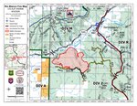
The map included with this update was built yesterday evening. A new map reflecting the recently-updated acreage will be published when it becomes available.
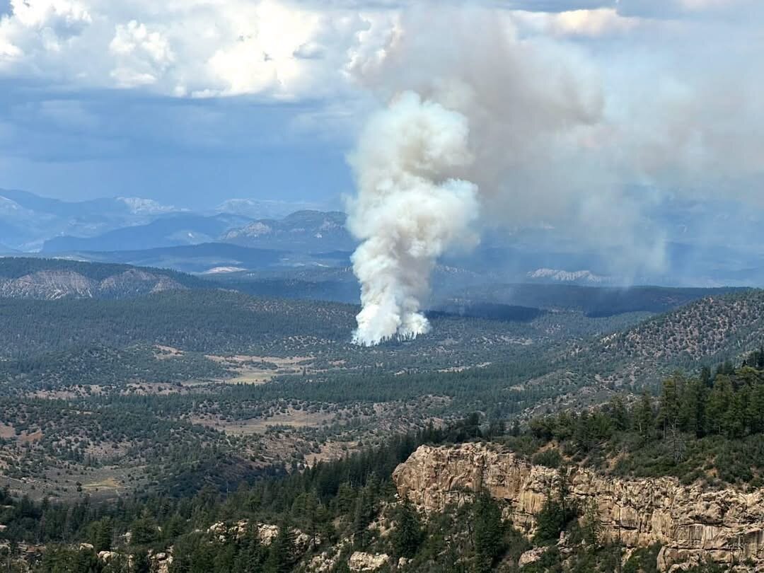
Current Situation: The Rio Blanco Fire is burning approximately 12 miles south of Pagosa Springs, CO, south of Eightmile Mesa. On Thursday, hot, breezy weather drove the fire north over the canyon rim above County Road 335 and east across Archuleta Canyon. The dozer line to the east of Archuleta Canyon was compromised yesterday due to spot fires resulting from group torching of conifer trees. The Navajo and Blue Ridge Hotshots worked to catch those spot fires and hold the dozer line, supported by multiple helicopters doing water drops. By 10 pm, the crews had contained the spot fires and the main fire activity had settled down. A night shift remained on the fire overnight to protect structures and monitor fire behavior.
Today’s Operations: More resources have begun to arrive, bringing the personnel on the fire to nearly double that of yesterday. The majority of resources are staffing Divisions M and Z, doing structure protection on homes in the County Road 335 corridor and working hard to slow the fire’s spread to the north and east. This work includes preparing structures and adjacent vegetation to increase the probability that they will not be impacted by the fire as it approaches. Structure protection efforts include digging line around homes in the fire’s path, removing flammable materials and vegetation away from buildings, and assembling and plumbing sprinkler kits to wet structures in advance of the fire front. Fire managers are continuously evaluating options to more directly engage the fire as it continues moving down the rim.
San Juan Team 8 is working closely with partner agencies, developing strategies to keep fire west of U.S. 84 and protect communities. The difficulty in constructing an effective fire break down the rim forces fire managers to consider more favorable terrain where there is a higher probability of success. On the south and west sides of the fire, crews are still working to keep the fire north and east of Forest Road 653.B. They have had good success holding this edge over the past two days. However, they are also scouting ahead for more options if the fire overcomes FR 653.B.
Closures/Evacuations: The Archuleta County Sheriff’s Office has issued an evacuation order for County Road 335 Lower Blanco, and pre-evacuation orders in place for County Road 337, 339, and Pinion Hills area along County Road 500. The Valle Seco Road (NFSR 653) and all spur roads are closed to the public. The public should avoid the area north of the Valle Seco Road. Contact the Archuleta County Sheriff’s Office at (970) 508-9928 for more information about evacuations and closures.
Weather: As forecasted, Thursday was warmer and drier than earlier this week. Slight chances for showers and thunderstorms exist for the fire area in the late afternoon and evening over the next couple days, with associated risks for lightning and strong outflow winds gusting 30-45 mph. Outside of these scattered storms, expect light winds, dry conditions and warm temperatures 5-10 degrees above normal.
Reminder: If you fly, we can’t. A Temporary Flight Restriction (TFR) will be implemented over the fire area. More information about the TFR will be posted as soon as possible. Private aircraft, including drones, are not allowed.
Update, 9:28 a.m., July 31:
Last night, crews patrolled and monitored the fire and observed minimal activity. Firefighters have been briefed this morning to discuss strategies for fire suppression and structure protection tactics and are headed out to the field.
Update, 9:32 p.m., July 30:
Evening update: The fire grew north to the rim above the Lower Blanco, dropping into the unnamed drainage between Frio and Archuleta Canyons. Crews worked on structure protection at homes threatened by fire along the CR 335 corridor and utilized helicopters to cool a spot fire and a "slopover" that both crossed the dozer line into Archuleta Canyon.
Air resources are a critical component of wildfire suppression, and multiple aircraft types have been supporting efforts on the Rio Blanco Fire. These include five Type 1 Blackhawk helicopters, two Type 2 Bell 205 helicopters, and several fixed-wing large air tankers. Each aircraft plays an essential role in reinforcing the work being carried out by crews on the ground: right tool for the right job. During the first 48 hours of initial attack, air tankers completed 32 missions, delivering 85,776 gallons of retardant to the fire. Today, helicopters contributed an additional 82,477 gallons of water to further support ground operations.
Effective aircraft support relies on strong collaboration. We appreciate the assistance provided over the past several days by air resources from Grand Junction and Colorado Springs tanker bases, and from the Gold Mountain Fire, as well as the excellent coordination from the staff at the Pagosa Airport.
Update, 6:27 p.m., July 30:
The Rio Blanco Fire is 709 acres, still with 0% containment.
Update, 3:53 p.m., July 30:
According to the Colorado Division of Fire Prevention and Control, the Rio Blanco fire has been calculated at 687 acres as of 3 p.m. Pagosa Springs High School remains the current evacuation center. Large animals can be housed at the CSU Extension building on U.S. 84.
Update, 2:33 p.m., July 30:
This is a secondary mandatory evacuation for County Road 335 due to the Rio Blanco Fire. We strongly urge residents to evacuate and check into the evacuation center at the Pagosa Springs High School. Please follow the Archuleta County Sheriff’s Office for more information or call the emergency call center at 970-508-9928.
Update, 11:33 a.m., July 30:
The Rio Blanco Fire near Pagosa Springs continues to burn, and aircraft combatting the fire are dipping buckets into Echo Canyon Reservoir State Wildlife Area.
Colorado Parks and Wildlife asks the public with both motorized vessels and hand-launched watercrafts to avoid operations west of the peninsula. Please give the aircraft space so they can safely operate and continue the excellent work fighting this fire.
Update, 10:12 a.m., July 30:
Acres: 440 | Containment: 0% | Reported: 07/28/26 | Cause: Lightning | Personnel: 91
The Rio Blanco Fire was determined to be lightning-caused, likely a hold-over from storms a day or two prior to its detection. On Wednesday, firefighters focused on evaluating structure protection options and developing a strategy to contain the Rio Blanco Fire. Fire behavior moderated after rain fell over the fire area Tuesday evening. Even with the moisture the previous day, fire activity increased in the late afternoon on several portions of the fire. Aerial resources were very active over the fire during the day and included both airtankers using retardant to slow growth and up to six helicopters working along Archuleta Canyon that dropped 85,000 gallons of water. Engine crews assessed structures to the north, while a dozer cut line from the northeast rim of Archuleta Canyon down to the bottom. The Navajo Hotshots improved this dozer cut, removing additional vegetation to moderate fire behavior against the line to prevent fire spotting.
After appropriately managing risks to fire personnel, protecting life, property, and infrastructure remain the top priority while the incident management team develops strategies to extinguish this fire. Challenges include the terrain, especially in Archuleta Canyon, and fuels, which include some extremely drought-stressed and insect-killed stands of spruce and fir. Nationally, demand is high for firefighters capable of working in challenging terrain and conditions. This competition has delayed arrival of supporting resources, including aircraft, engines, crews, and various overhead and support positions. The Rio Blanco fire is expecting two critical resources today, including Kern Valley Helitack and Blue Ridge Interagency Hotshots.
Today’s Operations:
Engines will remain in threatened neighborhoods to implement structure protection measures. Crews are scouting for options to build line across Archuleta canyon and back up the west side to tie in on the opposite rim. This would be an indirect fireline that could be used to stop the fire if it progresses downcanyon.
Between Frio Canyon and Archuleta Canyon, the northward progression of the fire was slowed yesterday by retardant drops by air tankers and helicopter water drops. Today, these aerial operations will continue, with the goal of preventing the fire from dropping over the rim into the Lower Blanco.
On the southern edge of the fire, along the 653 B Road, patchy fuels resulted in more moderate fire behavior where firefighters can work direct on the fire’s edge. Dozers backed up by Kern Valley Helitack firefighters will improve the 653 B Road as a fireline, and then work towards the north along the west flank of the fire.
Closures/Evacuations: The Archuleta County Sheriff’s Office has issued an evacuation order for County Road 335 Lower Blanco, and pre-evacuation orders in place for County Road 337, 339, and Pinion Hills area along County Road 500. The Valle Seco Road (NFSR 653) and all spur roads are closed to the public. The public should avoid the area north of the Valle Seco Road. Contact the Archuleta County Sheriff’s Office at (970) 508-9928 for more information about evacuations and closures.
Weather: Drier air arrives on Thursday, limiting shower and thunderstorm chances to the higher terrain adjacent to the fire location. These storms could produce outflow winds that impact fire behavior in the late afternoon or early evening. Temperatures will steadily increase through the weekend, and daytime minimum humidity values will begin to drop into the teens.
Update, 8:55 a.m., July 30: A fire crew stayed on last night to patrol and monitor fire activity and reported that the fire settled down and didn't experience significant growth thanks to an inversion layer over the area. Firefighters have been briefed and are headed out to the fire area for another day of building fire line and protecting structures.
Update, 9:28 p.m., July 29:
Evening update: The last measured acreage was 440 acres, calculated by an infrared flight at 10 a.m. this morning. Fire managers requested a second flight for this afternoon but, due to a high number of new fire starts across the state, the Multi Mission Aircraft were unable to provide a second measurement. Another infrared flight is on order for tomorrow morning.
Firefighters made progress today prepping structures threatened by fire along County Road 335 and building dozer lines along the east and southwest flanks. Crews observed moderated fire behavior this morning thanks to rain overnight. However, hotter and drier conditions this afternoon allowed the fire to move into lighter fuels like grasses, producing more smoke. Helicopters made 85 drops of approximately 45,000 gallons of water. Air tankers made numerous retardant drops, as well, which helped slow the advance of the fire.
Tomorrow, fire crews and operators plan to build more dozer and hand line along NFRS 653.B and the rim of Archuleta Canyon, as well as continue their structure protection efforts. Air operations will continue supporting ground crews with water and retardant drops.
Update, 7:35 p.m., July 29:
From the incident management team: The Navajo Interagency Hotshot Crew arrived today from Arizona on the Rio Blanco Fire. The crew is tied in on the east side of Archuleta Canyon where a dozer cut fire line running top to bottom at the mouth of the canyon earlier today.
The crew is prepping the dozer line for potential indirect firing operations in case the fire pushes north by clearing oak brush and other vegetation within 30 feet of the control line to mitigate fire behavior so that the line will hold. This work is critical to accomplish while fire behavior is moderate. Big thanks to this crew for their hard work.
When a new incident emerges, our highest priority is always the safety of personnel and the protection of life, property and the environment.
Original: At about 3 p.m. on Tuesday, July 28, the Rio Blanco Fire started 12 miles south of Pagosa Springs, with the Archuleta County Sheriff’s Office (ACSO) calling it a “rapidly growing wildfire” and issuing evacuation and pre-evacuation notices.
By midday Wednesday, July 29, the fire was estimated at 439 acres, with the incident management indicating the fire perimeter was mapped by aerial resources at 9 a.m. Wednesday morning.
The fire, according to the incident management team, is burning south of Pagosa Springs on Valle Seco B Road (NFSR 653.B).
At 4:10 p.m., the ACSO issued a pre-evacuation warning for the Lower Blanco area. At 4:29 p.m., an evacuation order was put out for County Road 335 (Lower Blanco Road).
At 6:18 p.m., a pre-evacuation warning was issued for the Pinon Hills subdivision, and a pre-evacuation order followed at 6:43 p.m. for County Road 337 and County Road 339.
That evening, the fire was estimated at 120 acres and the San Juan National Forest announced ground crews were on scene sizing up the fire and working to protect structures, utilizing dozer lines, engines and aerial support.
The agency stated in an update it is “taking aggressive actions to suppress this wildfire. Structure and resource protection, as well as firefighter and public safety are the main priorities for this incident.”
On Wednesday, San Juan Team 8 — the local type three incident management team, which traveled from the Ferris Fire in Dolores — took over management of the incident for the U.S. Forest Service.
“The fire exhibited extreme fire behavior and grew rapidly in just a few hours, but it received some moisture yesterday afternoon and into the evening that moderated fire behavior,” a Wednesday update from the incident management team states. “No structures have been impacted but the fire has burned within 1/4 mile of private property on the north flank.”
In the Wednesday update, the incident management team explains firefighters would continue to look for the best spots to access and build containment lines to protect structures in the County Road 335 area.
“Aerial resources will be on scene to slow the fire’s spread and moderate hot spots,” it states. “Deliberate efforts are being made to protect lives, property, and infrastructure, while ensuring firefighter safety.”
It adds multiple resources — including engines, dozers, hand crews and large air tankers are on scene — as well as an aerial supervision platform to provide oversight of the fire.
Additional resources were ordered, it states, though competition for resources is high nationwide due to high fire activity.
Additional Rio Blanco Fire updates will be posted at www.PagosaSUN.com as they become available.
Evacuation, pre-evacuation orders remain in place
As of midday Wednesday, the evacuation and pre-evacuation orders remained in place.
Additionally, Valle Seco Road (NFSR 653) and all spur roads are closed to the public.
The incident management team states the public should avoid the area north of the Valle Seco Road.
On Wednesday, Archuleta County Sheriff Mike Le Roux indicated the evacuations and pre-evacuations would likely stay in place until at least Thursday to allow fire managers to better understand what the northeast side of the fire is doing.
The intent, he noted, is to get everybody back as quickly as possible.
He added a checkpoint is in place at the evacuation site at County Road 335, with law enforcement accompanying people to their homes if they’ve forgotten medications or other needed items.
Le Roux noted not everyone chose to leave, but that the mandatory evacuation zone along the County Road 335 corridor includes 312 parcels that include 284 address points and 480 structures (including outbuildings).
Le Roux noted that, because not everyone chose to leave for the evacuation and the fire wasn’t threatening above-ground infrastructure, the decision was made to leave the power on in the area.
Le Roux added the pre-evacuation zone includes 113 address points on 162 parcels and 283 total structures.
An evacuation shelter is in place at Pagosa Springs High School, with the fairgrounds available for livestock and the Pagosa Springs Humane Society available for smaller domestic animals.
Cloman Park temporarily closed
On Wednesday, Archuleta County announced Cloman Park is closed until further notice due to the fire.
Temporary flight restriction in place
A temporary flight restriction (TFR) has been implemented over the fire area. Private aircraft, including drones, are not allowed.
Call center
According to Le Roux, Upper San Juan Search and Rescue is operating an incident call center at (970) 508-9928.
The call center is currently active from 8 a.m. to 10 p.m.
randi@pagosasun.com


 >