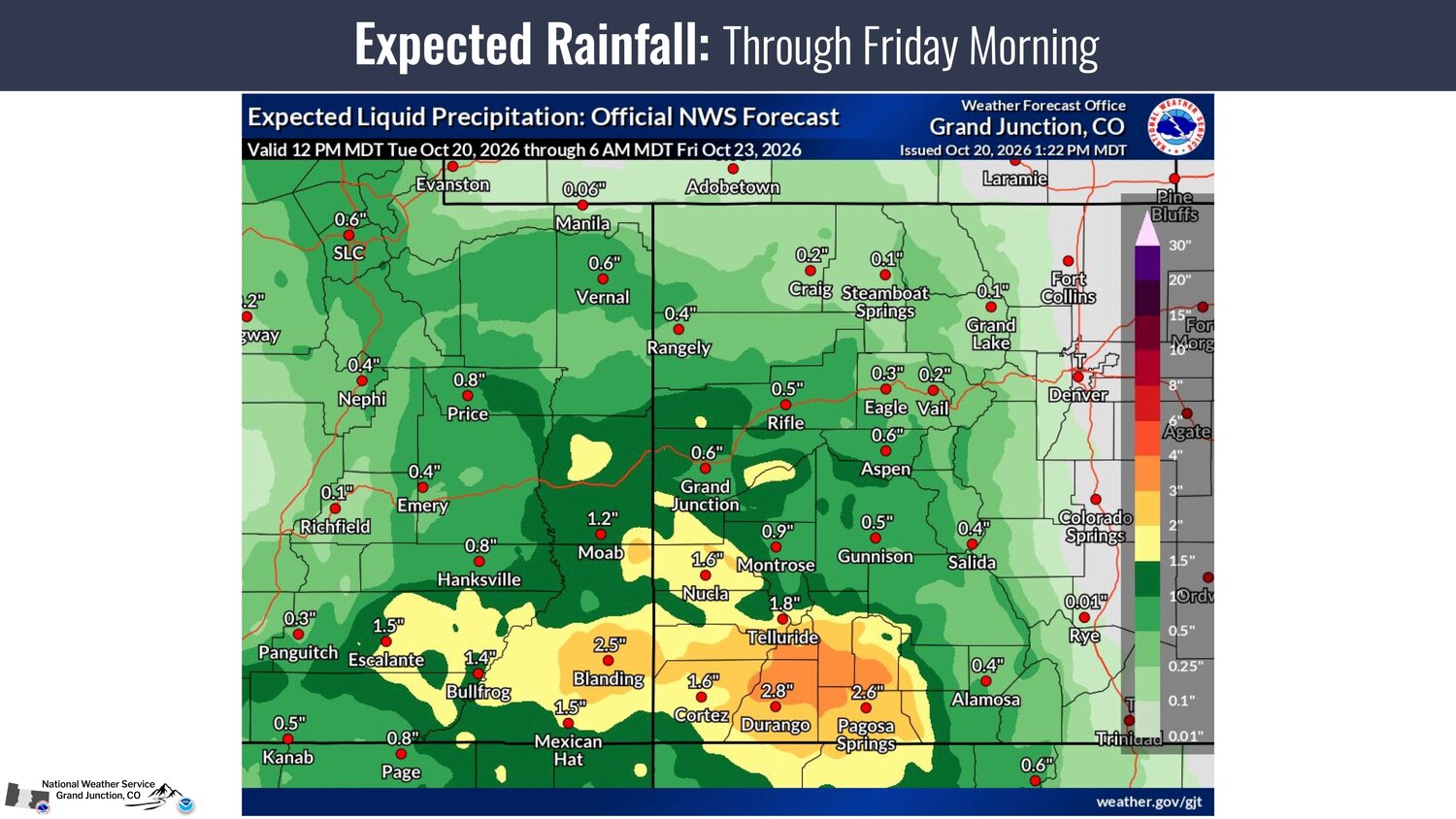
According to the National Weather Service (NWS), moderate to heavy rainfall is expected this week, with the highest potential for impactful weather being from Wednesday afternoon through Friday morning.
A flood watch in effect from noon Wednesday until noon Friday.
The NWS notes, "Rainfall totals of 1 to 3 inches are possible across the southwest San Juans, Abajos, La Sal mountains & surrounding valleys, with locally higher amounts possible."
It adds the heavy rainfall may result in flooding or flash flooding of small creeks, arroyos, rivers and streams. Debris flows and rockslides are possible in recent burn scars and steep canyons/mountain corridors.
The agency further notes, "Isolated strong to severe storms capable of producing damaging winds, large hail, and brief tornadoes" on Wednesday from late afternoon through sunset and on Thursday afternoon and evening.
Data from the NWS and Colorado Basin River Forecast Center further indicate the San Juan River at Pagosa Springs could crest around 10.75 feet around midnight Friday, above the flood stage level of 10.5 feet.
Sandbags will be available for county residents beginning Wednesday, Oct. 21.


 >