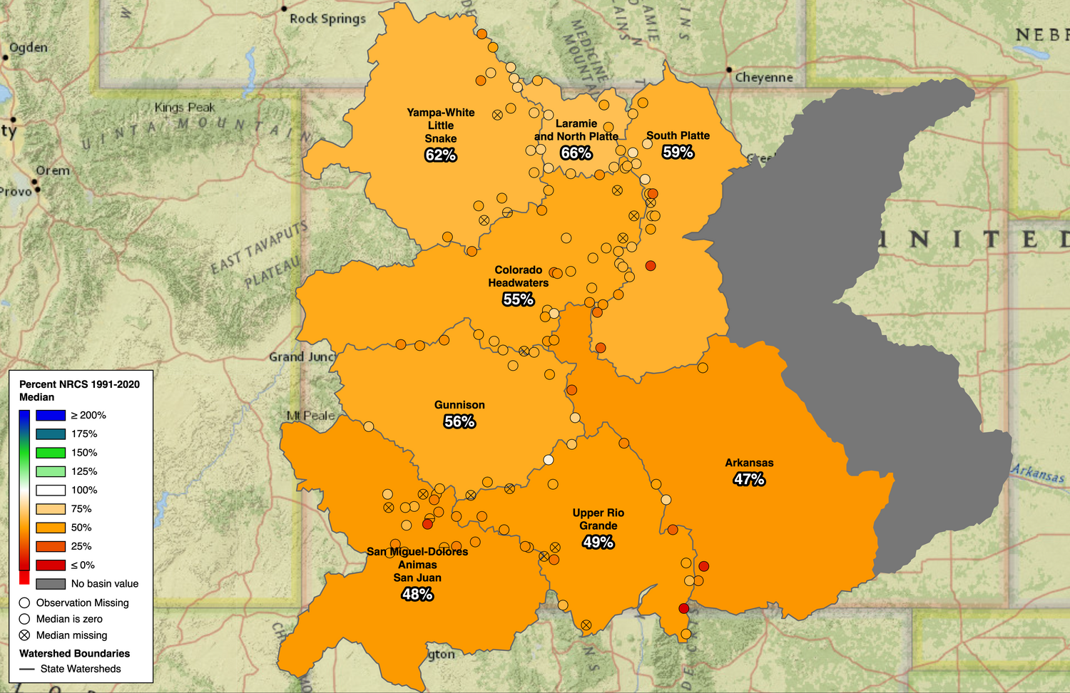
While many across the nation turned toward any number of rodents for a spring weather forecast on Monday, Feb. 2, many in Colorado have been left wondering when winter-like weather will start as the state continues to experience the lowest snowpack on record.
As of the end of the day on Feb. 3, the San Miguel, Dolores, Animas and San Juan river basins sat at 48 percent of median in terms of snow water equivalent (SWE), according to the Colorado SNOTEL Snowpack Update Report.
As of Feb. 4, the Wolf Creek summit — which sits at an elevation of 10,930 feet — had 9.0 inches of SWE, which compares to a Feb. 4 median of 19.6 inches, putting it at 46 percent of median.
The site’s median peak date is April 29, with a median peak of 35.5 inches. That puts the Wolf Creek summit at 25 percent of the median peak SWE.
The nearby Upper San Juan SNOTEL site, which sits at 10,140 feet, held 8.0 inches of SWE as of Feb. 4, compared to a median of 17.7 inches, putting it at 45 percent of the day’s median.
The site’s median peak is 29.7 inches, with the median peak date of April 9. The site sits at 27 percent of the median peak.
The state as a whole continues to experience the worst snowpack on record at a statewide median of 55 percent as of Feb. 3, with much of the western United States also sitting well below median SWE.
The conditions are also being reflected by the U.S. Drought Monitor’s map, which shows all of Archuleta County being in drought.
According to the Jan. 29 update, 100 percent of the county is abnormally dry, with 47.98 percent — primarily the northern half of the county — being in moderate drought.
The drought status is better than a year ago, however.
One year prior, when all of Archuleta County was also in drought, 79.95 percent of the county fell into the severe drought category.
Forecasters are predicting some moisture could move into the area next week.
The National Weather Service’s Climate Prediction Center predicts chances for below-average precipitation for the area and above-normal temperatures for February, though the 6-10 Day Outlooks forecasts above-average chances for precipitation.
According to Pagosa Weather, the area will be dry and see “Lots of sun and temps around 10 degrees above average,” but could see a more active weather pattern beginning around Feb. 10 and 11.
According to a forecast written by Pagosa Weather’s Shawn Prochazka on Feb. 2, “The models continue to indicate a more active weather pattern starting 10 or 11 Feb. Precip amounts are gradually trending up – yay!”
randi@pagosasun.com


 >
>