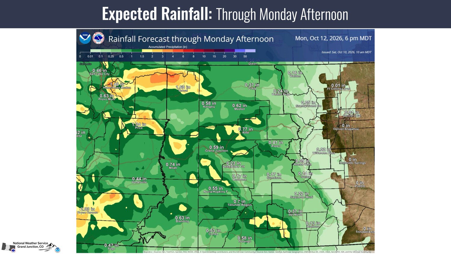
According to the National Weather Service (NWS), moderate to heavy rainfall is expected, with rainfall totals of 1 to 3 inces possible across the San Juan Mountains and surrounding valleys.
Heavy rainfall may result in flooding or flash flooding of small creeks, arroyos, rivers and streams, according to the agency. Debris flows and rockslides are possible over recent burn scars and steep canyon/mountain corridors.
The NWS states the highest potential for impactful weather is Sunday afternoon through Sunday night.
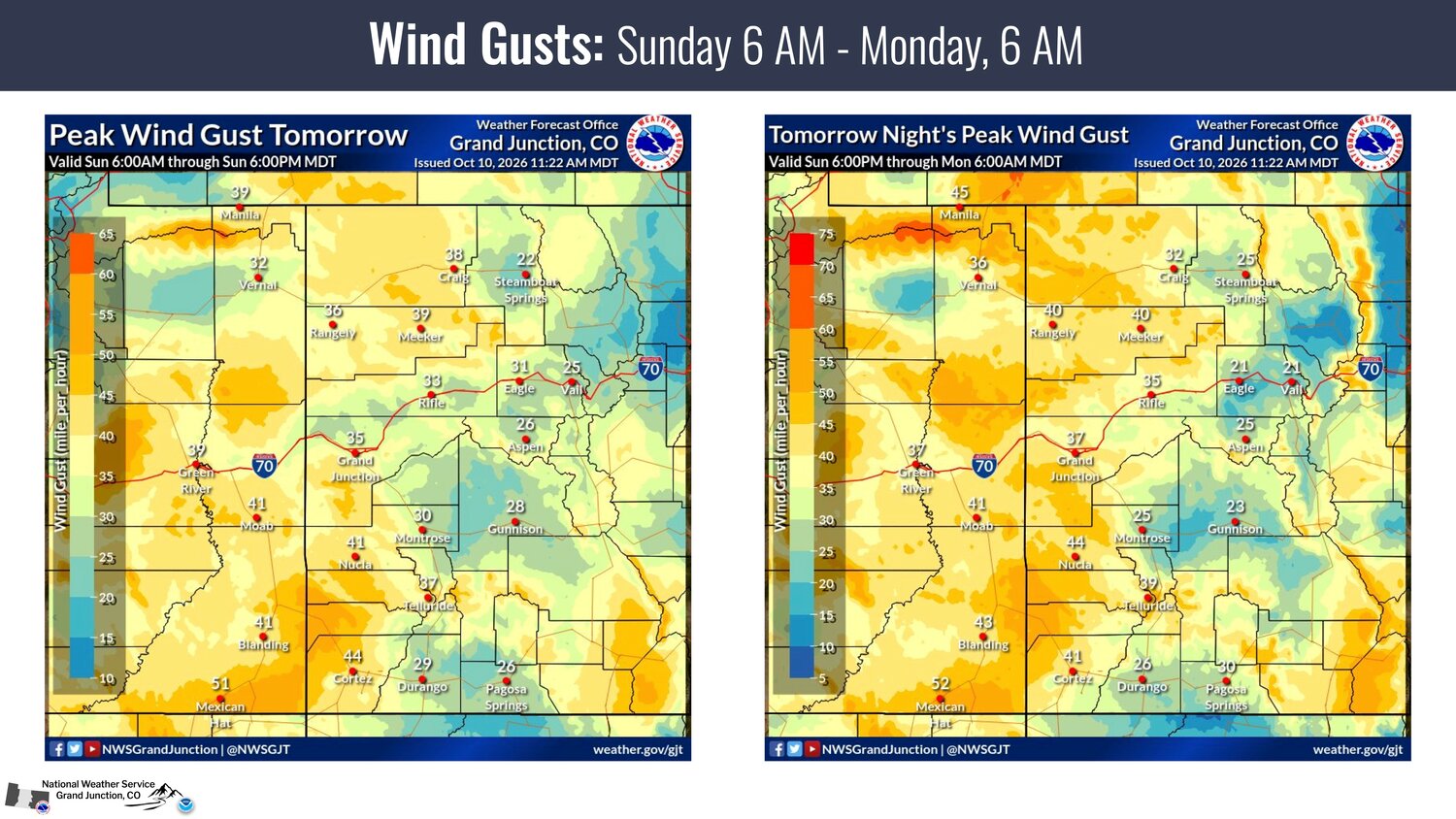
It further states wind gusts up to 40-50 mph are expected Sunday through Monday morning. Gusts upwards of 50-60 mph are possible, especially within the high terrain. A wind advisory is in effect for parts of southeast Utah and southwest Colorado from 9 a.m. Sunday through 12 a.m. Monday.
Thunderstorms may be capable of producing damaging winds, heavy rainfall and hail Sunday
afternoon, according to the NWS. Highest probability in eastern Utah and far western Colorado.


 >
>