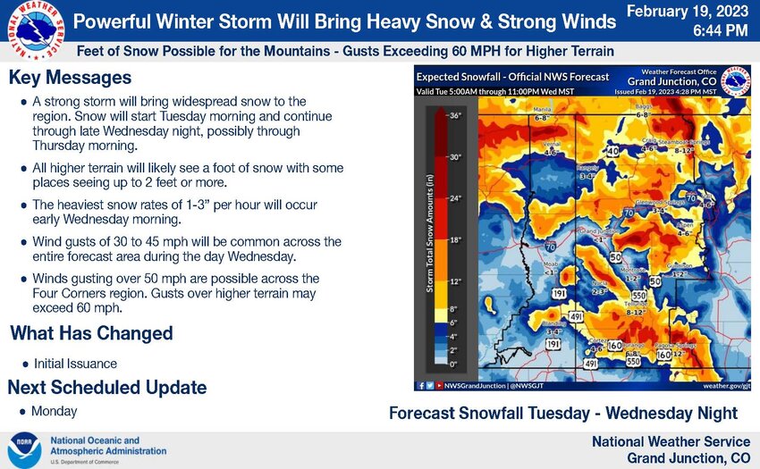
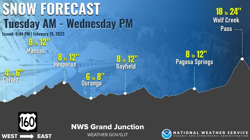
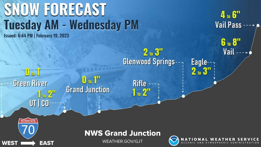
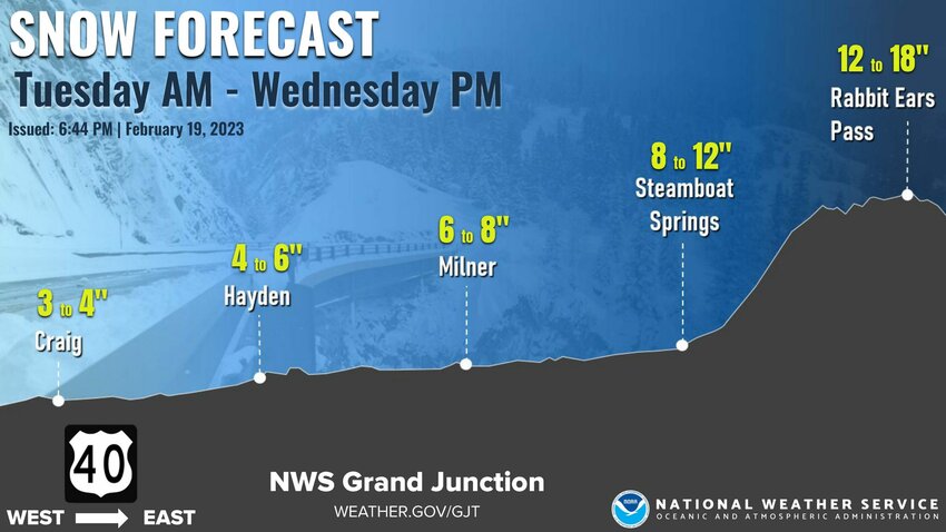
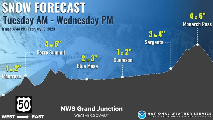
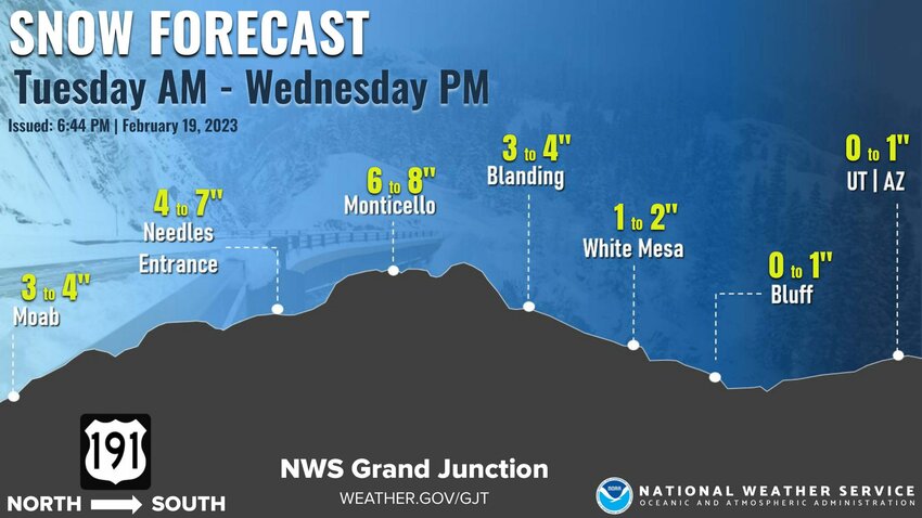
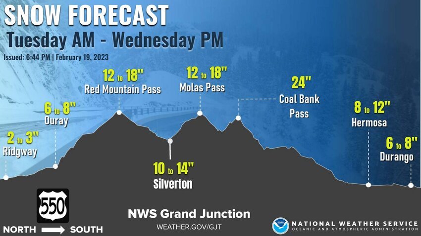
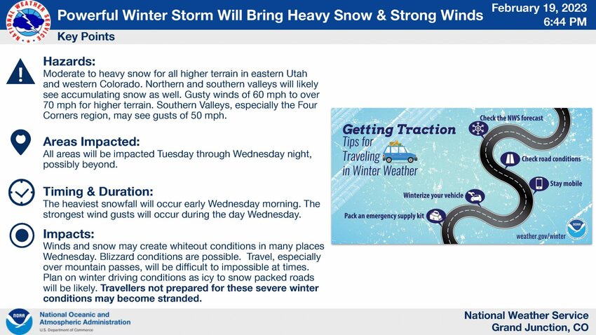
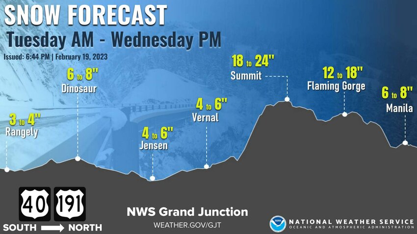
According to the National Weather Service, a strong winter storm will begin to affect eastern Utah and western Colorado Tuesday morning and continue through late Wednesday night, possibly beyond.
All higher terrain is expected to see a foot of snow with some places seeing up to 2 feet or more.
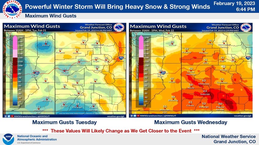
Wind gusts of 30 to 45 mph will be common across the entire forecast area during the day Wednesday.
Winds gusting over 50 mph are possible across the Four Corners region. Gusts over higher terrain will likely exceed 60 mph.
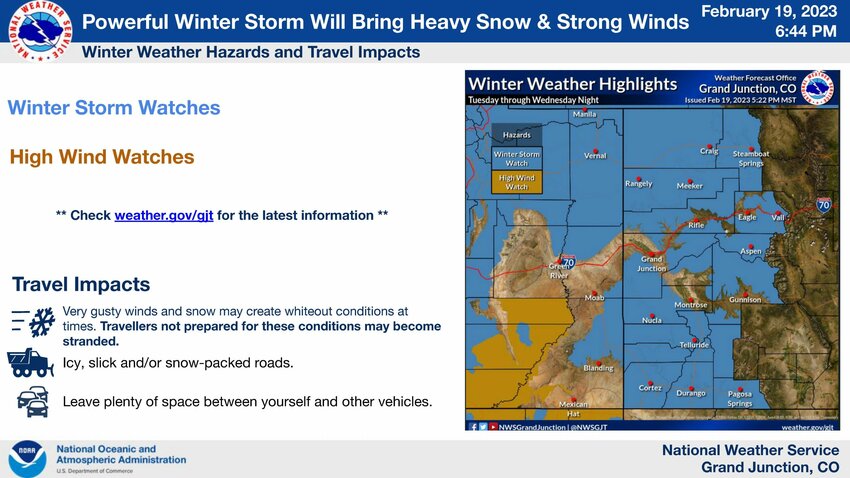
Winds and snow may create whiteout conditions on Wednesday. Travel, especially over mountain passes, may be difficult to impossible. Those drivers/travellers not prepared for these winter weather conditions may become stranded.
